
The headline
The two Sydney transport hubs flagged for around 12,000 new homes between them are Cherrybrook, on the Metro North West line, and Parramatta North, on the Parramatta Light Rail corridor. The NSW Government finalised the rezoning of both precincts in August 2026: up to 10,000 homes at Cherrybrook and around 2,000 at Parramatta North.
Both are state-led rezonings — the Government, rather than the local council, prepared and finalised the controls. They are the latest in a steady run of station-precinct announcements, and for anyone buying, selling or investing in Sydney, the pattern behind these announcements matters more than any single one. Detail on each is below, followed by the other Sydney station precincts where figures have been published.
Cherrybrook
The finalised Cherrybrook Precinct rezoning enables up to 10,000 new homes and more than 200 new retail jobs in Sydney's north-west, on land next to Cherrybrook Metro Station. At least 560 of those homes are to be affordable housing. The exhibited proposal set a minimum of 5 per cent affordable rental housing, rising to 10 per cent within the new town centre.
The precinct is centred on a new town centre with a library, community facilities, cafes and shops a short walk from the station. Building heights range from four to 27 storeys, with the tallest buildings located centrally around the metro station and town centre, stepping down towards the surrounding residential streets. Five new parks and five hectares of open space are part of the plan, and remnant Blue Gum High Forest is to be protected by incorporating it into public open space.
The proposal was on public exhibition between 7 November and 5 December 2025. Following community feedback, several changes were made before finalisation, including a provision for a new public primary school beyond 2041 and improvements to roads, cycling and walking paths. For performance information on schools currently serving the area, refer to ACARA's MySchool website.
For buyers, the practical point is scale relative to what was there before: Cherrybrook has been a low-density, leafy suburb, and the finalised controls introduce a genuine town centre with high-rise at its core. The precinct spans both The Hills and Hornsby local government areas, so the applicable council controls differ depending on which side of the boundary a property sits.
Parramatta North
The Government has finalised the rezoning of 33 hectares at Parramatta North and committed $124.5 million towards its transformation into a mixed-use community. The precinct sits along the Parramatta Light Rail corridor and is served by both the Ngara and the Children's Hospital stops, with access to the Parramatta CBD and the Westmead health and innovation district.
The rezoning provides for around 2,000 new homes, of which at least 100 are to be affordable, in buildings ranging from two to 23 storeys. It also makes provision for a new university campus supporting the Westmead health district, and up to 10 hectares of public open space including sports fields, extended riverside pathways, parks and gardens, plazas and play spaces. Reported job capacity for the precinct is up to 12,000 by 2047, including in health services and research linked to Westmead.
Heritage shapes the plan. The precinct adjoins the Parramatta Female Factory and Institutions Precinct — Australia's oldest surviving female convict factory site. Buildings of high or exceptional heritage significance are to be conserved, and the number and scale of buildings next to the Female Factory precinct were reduced through the master plan to open sightlines to and from the heritage buildings. The 6-hectare Female Factory and Institutions Precinct itself is not part of the rezoning and remains in government ownership.
Delivery is staged: underutilised government-owned land is to be progressively released over the next four years for housing, jobs and mixed-use development. That matters for timing — this is a release program, not a single construction start.
The bigger picture: rezoning around stations
The NSW Government announced its Transport Oriented Development (TOD) program in December 2023, aimed at creating more homes close to transport, jobs and services. Under it, eight Sydney transport hubs — the "tier one" precincts — were singled out for state-led accelerated rezoning, alongside a separate policy lifting capacity for mid-rise housing within 400 metres of 31 other transport hubs and town centres.
The program has moved from announcement to delivery. In February 2026 the Government finalised planning controls in four more precincts, working with Penrith City, Canterbury-Bankstown and Burwood councils, together unlocking more than 31,000 homes near metro and train stations. By June 2026 the final precinct, at Cockle Creek, was finalised — putting all 37 identified precincts into force. Cherrybrook and Parramatta North sit outside that 37-precinct list; they are separate state-led rezonings running in parallel.
Government estimates, not construction commitments
| All 37 TOD precincts (NSW) | 170,000 | Over 15 years; all precincts finalised by June 2026 |
| Eight tier-one Sydney transport hubs | 60,000 | Over 15 years; state-led accelerated rezoning |
| Four precincts finalised February 2026 | 31,000 | Controls finalised with councils |
| Burwood North Metro Precinct | 15,000 | State-led rezoning |
| Glenfield West | 1,200 | Rezoning proposal on public exhibition, February 2026 |
Figures are rounded government estimates drawn from different announcements and are not directly comparable.
St Marys
St Marys is one of the four precincts finalised in February 2026. Penrith City Council's tailored plan will unlock 11,500 homes — an extra 10,000 homes near the upcoming St Marys metro station compared with the previous controls — by allowing buildings of up to 18 storeys. The Government expects the plan to help create around 8,000 new jobs, with Queen Street rejuvenated as a mixed-use entertainment and dining precinct.
Planned improvements in the precinct include a new "Central Park", a future library and community hub, cycle and pedestrian links, and additional public open space. The council's masterplan exceeds the dwelling targets that the state's TOD controls would otherwise have set for the precinct, and also makes room for light industry through a consolidated commercial core.
For buyers, the practical point is that St Marys is being planned around a station that does not yet operate as a metro interchange. The rezoning is in place; the travel-time benefit arrives with the line.
Belmore and Lakemba
Two more of the February 2026 precincts sit in Sydney's inner south-west. Canterbury-Bankstown Council's alternative scheme unlocks more than 18,000 homes across Belmore and Lakemba, again allowing buildings of up to 18 storeys near the metro stations. The plan is aimed at revitalising both main streets, with shop-top housing, shops and services above and around retail frontages rather than a single tower cluster.
That matters for the character of each centre: growth is directed along established high streets, so the change is likely to be most visible to owners on and immediately behind those strips.
Bankstown
Bankstown is one of the eight state-led accelerated precincts. The rezoning proposal was exhibited for public consultation between 16 July and 30 August 2024, and its key features included capacity for up to 12,500 new homes close to the new Bankstown Metro station, potential to support 15,000 new jobs, and new open space, pathways and cycleways.
Bankstown also carries a stronger affordable housing requirement than the general TOD baseline: a mandatory contribution of 3 to 10 per cent for all new residential development in the precinct, which the department estimates would deliver between 375 and 1,250 affordable homes in perpetuity, managed by a registered community housing provider.
On infrastructure, the NSW Government has committed $520 million for active transport links and public open space across the TOD accelerated precincts, including new public open spaces under the Parks for People program at Bankstown, Bella Vista and Kellyville.
Burwood North
Further north, the Government is leading the rezoning of the Burwood North Metro Precinct to deliver around 15,000 homes around the future Sydney Metro West station, spanning the Burwood and Canada Bay council areas.
If you're buying
General points worth weighing up:
- Supply arrives in waves, not overnight. These are long pipelines — 15 years for the TOD precincts, and a four-year staged land release at Parramatta North. A rezoning finalised in 2026 may not translate into completed apartments for years, so don't assume immediate price relief in a precinct such as Cherrybrook, St Marys or Lakemba.
- Check the zoning, not just the listing. A house on a street inside a rezoned precinct now sits in a different planning context to one 1.5km away. That affects future neighbours, building heights and streetscape — heights of up to 27 storeys are in play at Cherrybrook, 23 storeys at Parramatta North, and 18 storeys at St Marys, Belmore and Lakemba.
- Amenity lags density. Ask what schools, open space and community facilities are committed in the precinct masterplan, and when. Cherrybrook has five new parks, a town centre library and a provision for a public primary school beyond 2041; St Marys has a new central park, library and community hub flagged.
- Construction is disruptive. If you're buying to live in for the medium term, factor in years of nearby building activity.
If you're selling
Owners of larger or amalgamation-friendly sites inside newly rezoned precincts — Bankstown's CBD blocks, the streets around Cherrybrook Metro Station and the Burwood North precinct are obvious examples — may find a different buyer pool, including developers, than they would have before the controls were finalised. Sites just outside a precinct boundary don't get the same uplift, so the boundary line is worth confirming on the NSW Planning Portal before setting expectations. At Cherrybrook, it is also worth confirming whether a property falls in The Hills or Hornsby, as the applicable controls differ.
If you're investing
This is general information only, not advice about your circumstances. Two structural factors are worth understanding:
- Affordable housing conditions. Developments meeting the relevant thresholds must set aside 2 per cent of floor area as affordable housing in perpetuity, managed by a registered community housing provider. Some precincts go further — Bankstown's proposal set a 3 to 10 per cent contribution, Cherrybrook's finalised rezoning includes at least 560 affordable homes and Parramatta North at least 100 — so check the controls for the specific precinct rather than assuming the baseline.
- Future competing stock. Higher rental yields near stations can be offset by a large volume of new, similar apartments completing in the same catchment. With up to 10,000 homes now enabled at Cherrybrook, 12,500 flagged at Bankstown and more than 18,000 across Belmore and Lakemba, look at how much is approved nearby, not just what exists today.
What to watch
Keep an eye on masterplans and exhibition periods for precincts near you — public exhibition is the point at which heights, boundaries and infrastructure commitments become visible. At Parramatta North, the staged release of government-owned land over the next four years is the schedule to follow. For school performance information relevant to a precinct, refer to ACARA's MySchool website.
If you'd like to talk through what a nearby rezoning means for a specific street or property, our Chatswood team is happy to help in English, Cantonese or Mandarin.
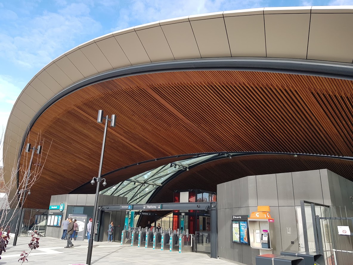
Hero image: the entrance of Cherrybrook Metro Station — photo by Photnart, CC BY-SA 4.0, via Openverse.